President Dwight D. Eisenhower signed the National Interstate and Defense Highways Act on June 29, 1956. The act enabled the creation of the largest highway network connecting all the states of the country. The building of this massive network of roads was the largest public works project in history. The original plan for the system is shown in the map below:
Click to enlarge
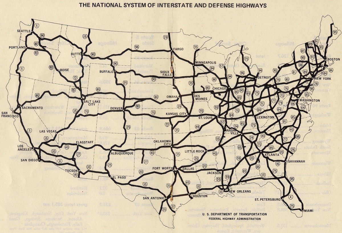
Via Michael Beschloss @ Twitter
The interstate system covers over 47,800 miles today and is one of the major drivers of economic activity. The interstate has helped trade and commerce flow efficiently between destinations.
The one thing that is frustrating with this network is the toll. Today the interstate is seen as a money-maker by the states and so toll is required to use many of them. For example, it is literally impossible to go east to west on the interstate across the country without paying a toll. The worst among the states is the state of New York with atrocious tolls for crossing bridges, tunnels, etc. After paying all the tolls on the NY roads one may wonder if the term “highway robbery” has a new meaning in today’s world.